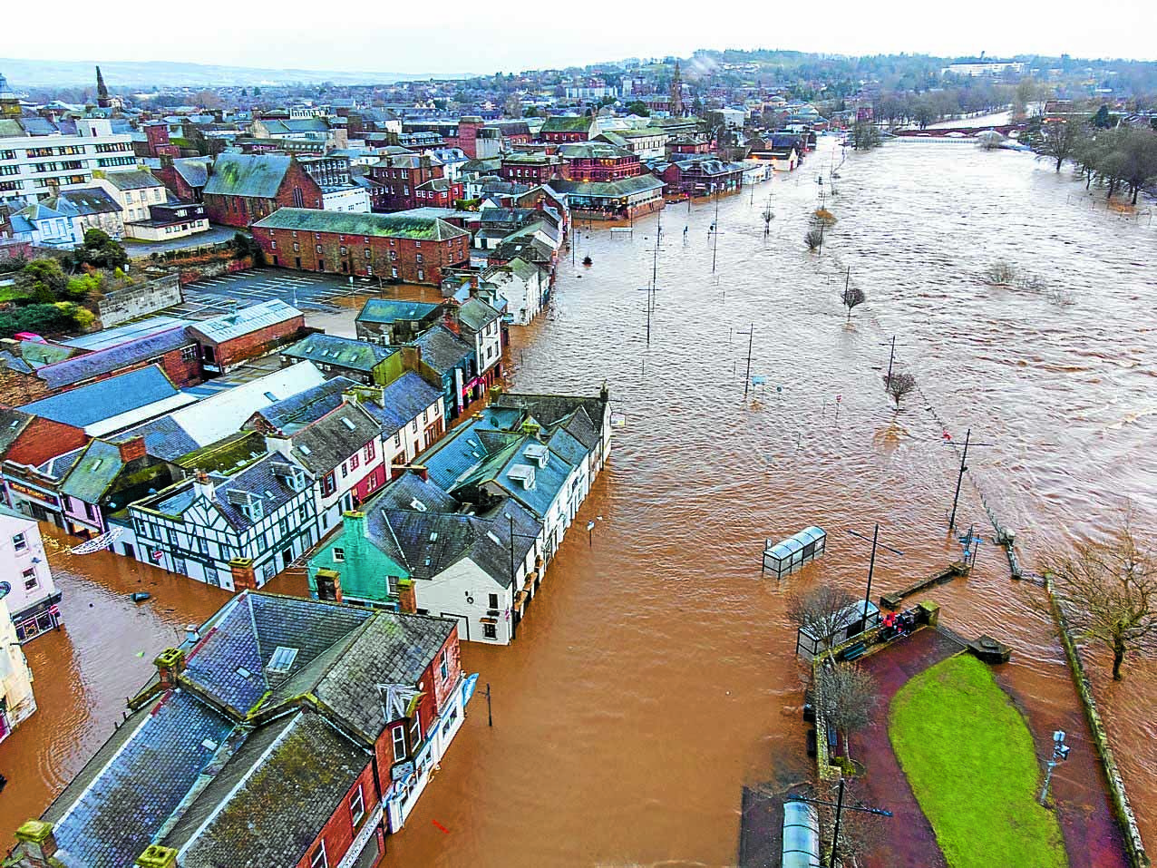
DUMFRIES and Galloway has been identified as a hotspot on new ‘future flood maps’ for the UK.
The detailed charts have been produced following research carried out by a team from Bristol University and Fathom, a UK scientific organisation that assesses flood and climate risk.
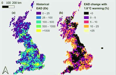
They simulate the impact of flooding on the whole of the country if climate goals are not met and show which areas are in particular danger.
According to the researchers, climate change of 1.8 degrees will especially impact on ‘hotspots’ where homes and businesses are in harm’s way – including Dumfries and Galloway.
The map reveals that a lot of this region, especially along the Solway coastline, could see a 10-25 per cent increase in the damage caused by flooding.

Furthermore, another Fathom map entitled ‘Flood Risk in 2050’ reveals that by then, up to 25 per cent more properties in Dumfries and Galloway will have at least a one per cent risk of flooding each year
The researchers say the detail is critical for future planning decisions. Co-author Dr Oliver Wing, who is chief research officer at Fathom and honorary research fellow at the University of Bristol, believes the findings are crucial to understanding flood risk in a warming world. He said: “Our model shows that there are many places where flood risk is growing. Being able to understand the communities where this is likely to happen allows us to make sensible investment decisions – about flood defence structures, natural flood management or even moving people out of harm’s way.”
“The modelling provides clear evidence that flood risk needs to be a bigger international priority and that current governance doesn’t go far enough. While the majority of the nation’s future flood risk already exists today, it is strongly in the UK’s interest to exercise leadership in global carbon emission reduction efforts, both by example and as part of global


