A PIONEERING project is helping lifeboats safely navigate the Solway Firth on rescue missions by harnessing data from satellites.
The estuary is regarded as one of the UK’s most treacherous stretches of coastline as it is exposed to some of the fastest tidal movements and ranges in Europe.
Large areas of mudflats surround the estuaries of the River Nith and River Annan, with many areas vulnerable to quicksand. Lifeboats must frequently navigate the areas at high speed, but even state-of-the-art marine navigation maps leave areas blank and uncharted, increasing the risk of the rescue services themselves becoming casualties.
The University of Strathclyde was approached by Nith Inshore Rescue with an idea to use satellite imagery to find channels through uncharted waters. Under the ‘Safe Passage’ project, funded by the European Space Agency (ESA), the research team are now using the estuary as a trial site to support safe navigation of the flats.
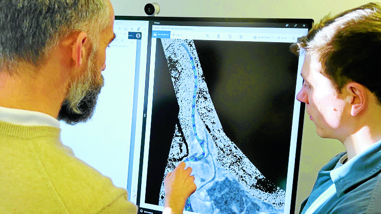
Researchers from the university’s Applied Space Technology Laboratory are investigating the use of synthetic aperture radar (SAR) data from satellites to provide regular, accurate mapping of moving channels in the coastal region.
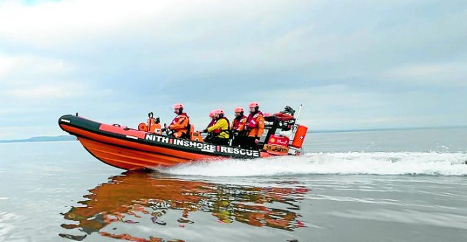
The data can differentiate between sand and water, and even works under dark or cloudy conditions, allowing the lifeboat to find the safest route.
Principal investigator, Professor Malcolm Macdonald, chair of Applied Space Technology at Strathclyde, said: “The crews were manually depth gauging the flats every fortnight but they can change on an almost daily basis. A key challenge is that we’re trying to provide an operational service to a volunteer crew, so we can’t just buy expensive, state-of-the art data.
“Optical satellite data – similar to how your phone works – works well in other parts of the world, but on the west coast of Scotland, you get predominantly pictures of clouds. Radar data penetrates the cloud but can be difficult to interpret, and so we started looking at how we could use that data.”
The volunteers now receive updated charts of satellite imagery generated waypoints, with the routes used in real life rescues.
Crew member Gwilym Gibbons, added “Working with the team is the key enabler of this innovative way to aid safe marine navigation for search and rescue.
“To see and test the results of the work in a real environment as an additional aid has already proved the huge potential this could have across the world.
“Our ambition is for Safe Passage to become a commercial navigation data feed service for a range of marine navigation uses, with a proportion of revenues generated going to support the vital work of our wholly volunteer lifeboat services.
“It’s literally saving lives at sea from space.”
