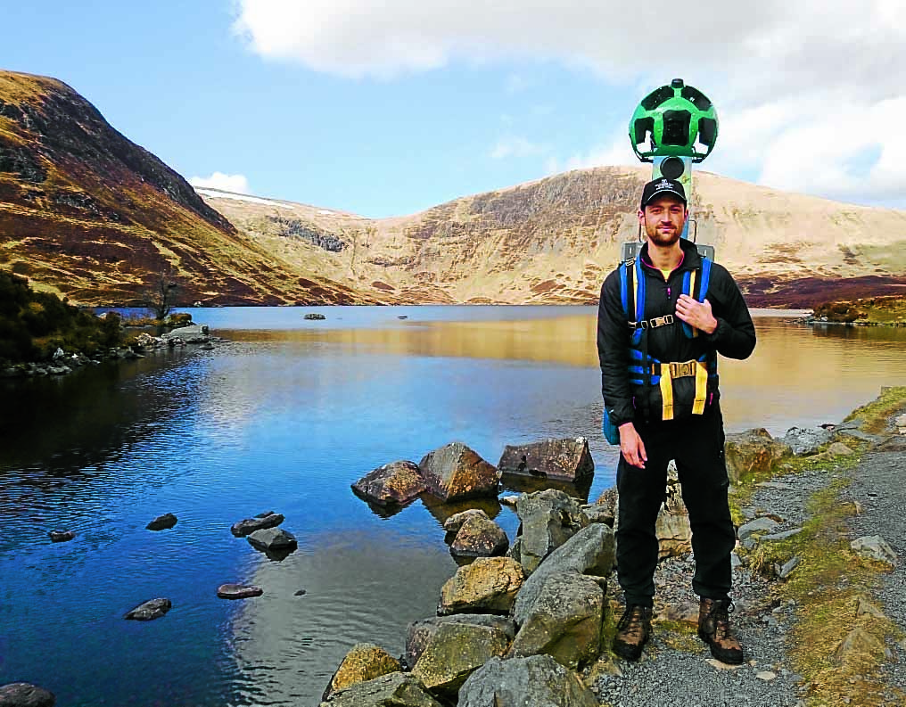
PICTURE PERFECT . . . National Trust for Scotland’s wildlife filming editor Simon Goodall at Loch Skeen, at the top of the Grey Mare’s Tail
One man has recorded some of Scotland’s highest and remotest regions using the Google Street View Trekker and the iconic waterfall north of Moffat has made the prestigious list.
Simon Goodall, the National Trust for Scotland’s wildlife filming editor, braved blizzards, rain and wind to capture stunning views of the trust’s countryside properties.
Street View cameras are more often associated with urban roads and streets, mounted onto cars to record but Simon used a Street View trekker, supplied by Google, to capture his unique footage.
The result is an captivating perspective of some of Scotland’s best known wild destinations, allowing online viewers to trace paths along mountain ridges or scan the landscape from island cliffs or high waterfalls.
Simon said: “We had the loan of the camera for two months and deciding which properties to feature was difficult given the extent of the Trust’s countryside properties, but we have captured mountains, waterfalls, islands and sealife.
“Like a normal camera, a spot of rain on the lens can completely ruin a shot, so using a camera like the Google Trekker with several lenses at 360 degrees in a notoriously wet country like Scotland – all while struggling to the top of a Munro – was a challenge.”
The 18kg camera was mounted on a rucksack style harness to allow him the relative agility to tackle wild paths in the company of trust rangers for added safety.
Laurian Clemence of Google UK said: “We are delighted to have worked with the National Trust of Scotland to bring Street View to their pristine areas of beauty.”


